

7 of the Best Day Hikes in North Cascades National Park
North Cascades National Park encompasses some of the most remote mountains in the lower 48 states…. and some of the best views
Known for the lack of roads, meaning long hiking distances to reach destinations, there are enough trails and hikes in North Cascades National Park to last a lifetime.
However, there are thankfully also plenty of beautiful hikes for a day’s walk. Here are a few of my favorite day hikes in North Cascades.
The Best Hikes in North Cascades National Park
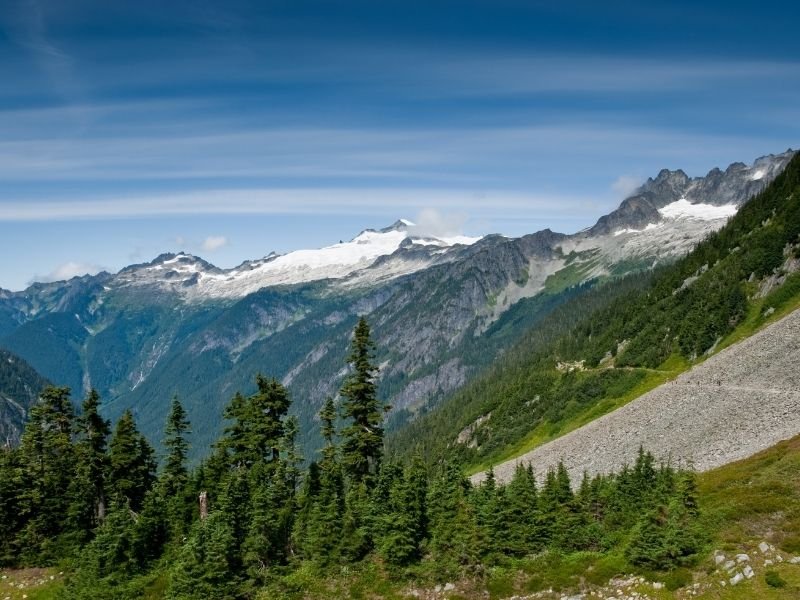
Cascade Pass
Total Length: 7 miles
Hike Type: Out and Back
Elevation Gain: 1800 ft
Difficulty: Moderate
Driving Directions: Take highway 20 to Marblemount and then continue onto Cascade River Road (proceed straight when highway 20 takes a left). Follow Cascade River Road 23 miles to the end of the road, where you will find the trailhead.
The Cascade Pass trail is a moderate-level hike, but it is the most popular hike in North Cascades National Park for a reason: it’s worth the climb!
A hike up this trail will grant you with fields of heather, snow-capped mountains vistas, and glacial carved valleys.
You may also find a marmot or two and some chipmunks along the way. Take care not to feed the chipmunks — they are already chubby enough.
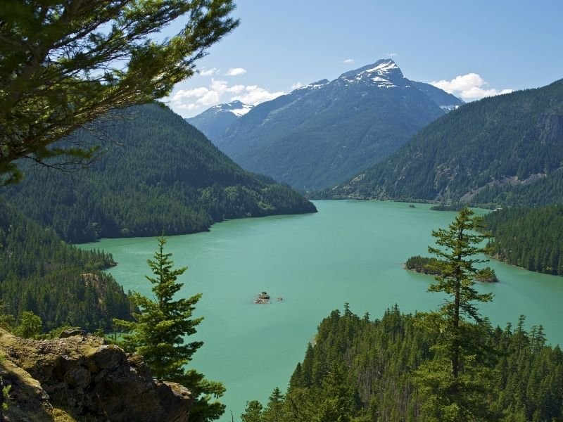
Diablo Lake
Total Length: 7.6 miles
Hike Type: Out and Back
Elevation Gain: 1400 ft
Difficulty: Moderate
Driving Directions: Drive east along highway 20 from Marblemount. After crossing the Gorge Lake bridge, drive another 1.5 miles, then turn left on Diablo Dam Road toward the North Cascades Environmental Learning Center. Cross the dam and drive to the end of the road, where you will find the trailhead.
Diablo Lake is a brilliant blue lake featured in many pictures from people hiking North Cascades National Park. Views like this are what make many people say the North Cascades is one of the best hiking destinations in the USA.
Smaller than the nearby Ross Lake, but equally as beautiful (or more), this trail features islands, deep gorges, waterfalls, and the stunning mountain peaks of the North Cascades.
This trail offers views of Diablo Lake throughout the hike and ends at a viewpoint overlooking Ross Lake and a picturesque bridge.
The trail begins with a beautiful walk through old-growth forest. When the trail emerges from the forest and crosses Deer Creek, there is a short side trail that offers a view of the lake.
From here, the trail reaches views of a waterfall and the surrounding peaks. The trail then reaches an overlook of Ross Lake and its Dam. You can continue down the steep trail to the suspension bridge or stop here and soak up the views.
If you want a change of pace on the return trip, you can enjoy a ride on the Diablo Lake Ferry back to the trailhead to experience the lake from a different perspective (and save some walking!). The ferry is operated by Seattle City Light from June to October.
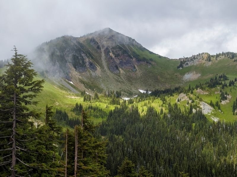
Sourdough Mountain
Total Length: 10.4 miles
Hike Type: Out and Back
Elevation Gain: 4870 ft
Difficulty: Hard
Driving Directions: Drive east along highway 20 from Marblemount for 22 miles. When you reach Diablo Dam Road, take a left. In 0.7 miles at cross the Stetattle River bridge, stay to the right, and reach the trailhead in 0.25 miles from the road split.
Sourdough Mountain is the site of one of the first fire lookouts established by the U.S. Forest Service, and the historic lookout building still stands at its peak.
To reach the lookout, you first begin with steep switchbacks in the forest. The first two miles of the trail gains 3000 ft of elevation with grueling switchbacks.
However, this effort will become worthwhile once you make it out of the forest, where you will be greeted with wildflower meadows and expansive views that get better as you go.
Although beautiful, this is not a beginner-friendly hike in North Cascades, and there are a few considerations to keep in mind.
Since this is a steep trail, occasionally narrow and loose, the trail will be easier with a pair of hiking poles. In addition, the trail is steep and there is no water access until a potential stream 4 miles from the trailhead.
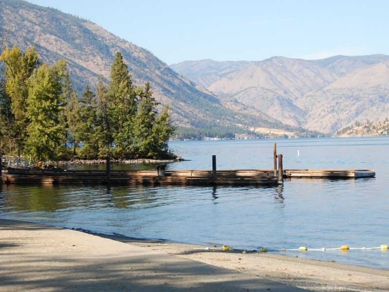
Stehekin River Trail
Total Length: 7.6 miles
Hike Type: Out and Back
Elevation Gain: 100 ft
Difficulty: Beginner
Driving Directions: This trail begins in the remote town of Stehekin, and to access this town you’ll need to take the Lady of the Lake ferry from Chelan. From the ferry dock in Stehekin, take a bus up the Stehekin Valley Road for 4.5 miles. You will find the trailhead after crossing Harlequin Bridge, following Company Creek Road to the airport, and walking to the end of the airport runway.
Explore the Southern side of the North Cascades National Park Complex with a visit to the town of Stehekin on Lake Chelan.
There are plenty of trails from town, but this shaded trail along the river is ideal for the warm summer day.
Better yet, the trail ends at Weaver Point at Lake Chelan, a campground with a bit of a sandy beach and view of the town.
The trail begins by wandering through the valley floor, giving you views of the neighboring mountains. About a mile into the hike, you will be greeted with your first view of the river and surrounding meadows.
Continue on from here until you reach Lake Chelan and enjoy the peaceful walk through the beautiful landscape.
Cutthroat Pass
Total Length: 10 miles
Hike Type: Out and Back
Elevation Gain: 2,000 feet
Difficulty: Hard
Driving Directions: Drive approximately 50 miles east on Highway 20 past Marblemount to Rainy Pass. Turn left (across from the road to Lake Ann), and drive down the road half a mile to the parking lot and trailhead for the Pacific Crest Trail.
You can’t go wrong with any hike on the Pacific Crest Trail (PCT), a 2,650 mile trail that extends from the Mexican border in California to the Canadian border in Washington, but this hike to Cutthroat Pass is on one of the best sections.
To reach Cutthroat Pass, you will follow the PCT from its Highway 20 crossing, 5 miles north towards Canada.
The trail begins with small creek crossings that may be running high, so be sure to cross carefully. As the trail continues, the forest thins, and you can see the mountains across the valley, before crossing through the granite-filled, heather meadows of the alpine.
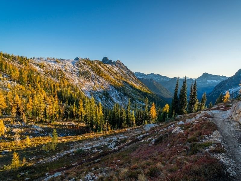
Upon reaching the pass, there are 360-degree views of the surrounding mountains to enjoy with your summit treats. This is also an excellent fall hike, as the larches will turn a brilliant yellow before winter comes.
Sauk Mountain
Total Length: 4.2 miles
Hike Type: Out and Back
Elevation Gain: 1200 ft
Difficulty: Moderate
Driving Directions: Take exit 232 off of I-5 to Highway 20, then after 35 miles, turn left onto Sauk Mountain Road (FS 1030). The trailhead is 8 miles down this steep, but generally passable road. It is worth reading recent trail reports on wta.com for an updated road report before you head out for this hike, as conditions vary throughout the season.
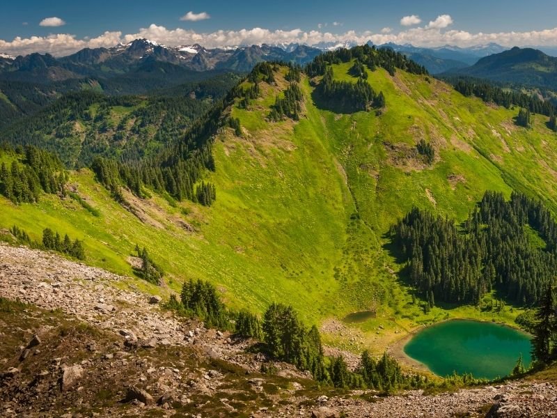
Sauk Mountain is one of my favorite hikes in the area because of the great variety you find along the trail.
Although outside the boundary of the national park, it showcases the best the region has to offer. It is never a slog, offering excitement throughout the entire trail, with views that grow continuously more impressive.
With the multitude of peaks that you can see from the trail, it is the perfect trail to bring along a map of the area for peak identification, or try out the PeakFinder app, an app that identifies visible peaks as you point your phone out on the horizon.
When you are not looking at the views, or if the clouds roll in, spend some time admiring the variety of wildflowers adorning the slopes, or listening for marmots squeaking as they run around the rocks.
Lake Ann
Total Length: 3.4 miles
Hike Type: Out & Back
Elevation Gain: 700 ft
Difficulty: Beginner
Driving Directions: Drive approximately 50 miles east on highway 20 past Marblemount. Stop at the Rainy Pass trailhead on the right side of the road.
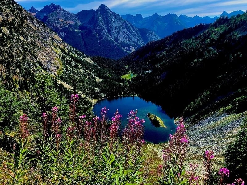
Not to be confused with Lake Ann near Mt. Shuksan, which is also a beautiful hike in the area, this Lake Ann is near Rainy Pass and the Maple Pass Loop.
Lake Ann is a crowd-pleaser for any season (besides winter, when the road closes), offering wildflowers in summer, larches in fall, and majestic snow-sprinkled mountains in early winter.
To find the trail from the parking lot, follow the “Lake Trail” signs. When you find a junction between a paved trail and a dirt trail, take the dirt trail to the right.
A mild hike through forest and wildflower meadows, this is a great stroll for any day. Lake Ann is the perfect alpine lake, with beautiful blue water lined by talus fields.
From the lake, you can return back the way you came or continue up to Maple Pass for a longer hike. It is possible to do a loop hike on the Maple Pass Trail, but prepare for double the distance and double the elevation gain.
Pin This Guide to Best Hikes in North Cascades National Park!


Abby Conner loves rugged mountain peaks, old-growth forests, and ferns. She spends as much time as she can outside hiking, camping, climbing, and identifying native plants. Abby firmly believes the West Coast is the Best Coast of the U.S. and denies she could place any of the states east of the Mississippi on a map. After moving around the Western U.S., she is glad to be back in Seattle. Follow her adventures at her blog Cedar Peaks & Trees and on Instagram.