The Perfect Weekend in Seattle: Your 2 Day Seattle Itinerary

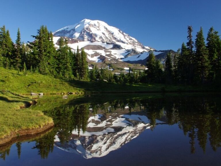
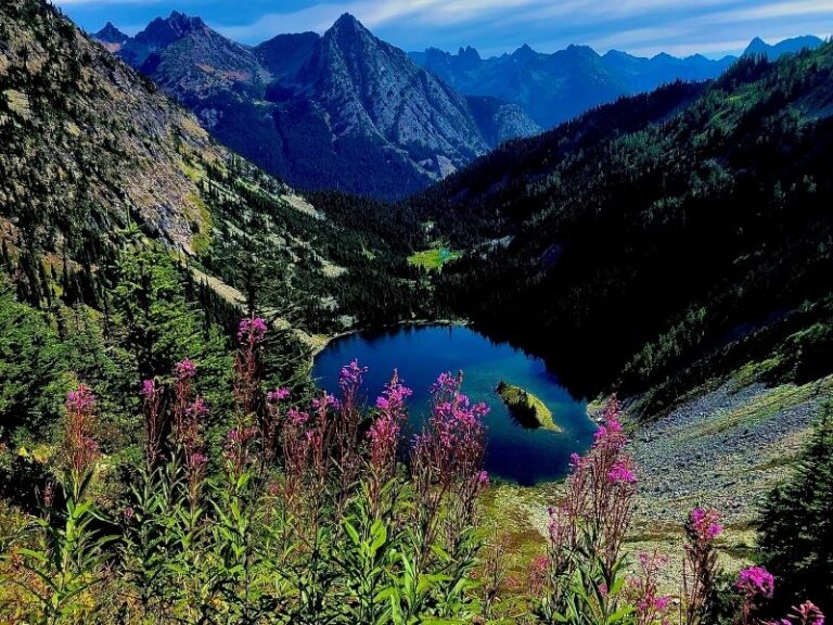
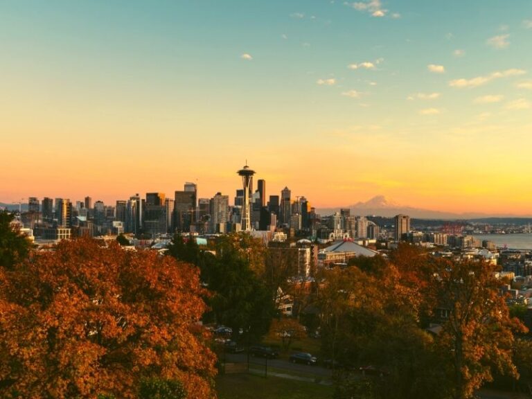
Seattle is a fun waterfront city located between Puget Sound and Lake Washington in Northwest Washington.

Known for coffee, bridges, evergreen forests, and rain, there are plenty of things to do on a weekend in Seattle!

Although rainy and dark from November through May, if you visit this beautiful Northwest city in July or August, you will find the perfect temperatures and bright sunshine!

If you ask me, these two months make up for the rest of the year, but then again, I grew up in Seattle, and I might be biased.

A weekend in Seattle isn’t long enough to see everything in the city, but for a quick 2 days in Seattle itinerary, I recommend visiting Downtown and the Fremont and Ballard neighborhoods to experience the best of what the metropolitan city has to offer.

Let’s begin this Seattle itinerary!

Your Weekend in Seattle Itinerary: Day One

Hit the original Starbucks bright and early

Spend Saturday morning exploring downtown Seattle and the many attractions near the waterfront.

Saturday morning is the perfect time to visit the original Starbucks near Pike Place Market, the first stop on this Seattle itinerary.

The Starbucks opens at 7 AM, and is a popular tourist spot, so show up before or around the opening time to avoid the long line.

Wander down the waterfront

With your mocha and pastry in hand, take a stroll along Seattle’s waterfront.

Head north along the piers towards the Olympic Sculpture Park. The Olympic Sculpture Park is a public park created by the Seattle Art Museum, featuring modern and contemporary outdoor sculptures along the beach.

The Sculpture Park is next to Myrtle Edwards Park, a long beachfront park with a walkway, perfect for extending your morning walk.

Head towards the Seattle Great Wheel

Once you’ve finished your coffee and morning snack, wander back the way you came towards the Seattle Great Wheel.

The Seattle Great Wheel is the tallest Ferris Wheel on the West Coast at 175 feet tall.

Although a relatively new Seattle attraction – it opened in 2012 – the wheel has quickly become a staple activity in downtown Seattle.

Riding a Ferris wheel on the pier is a fun way to view the boat traffic and bustle of the city!

Hit Pike Place Market

After a thrilling ride on the wheel, head up to Pike Place Market.

When you arrive, be sure to look above the market to see the famous sign with the neon letters and clock!

After snapping a picture, enter the market and wander around the businesses.

While exploring the stores, treat yourself and buy a few souvenirs.

As you are wandering, stop by the Market Rummage Hall to sort through the items for treasures and visit the Market Magic Shop and peruse the magic books and tricks throughout the shop.

Rachel’s Ginger Beer is also a local favorite and is located on the corner of Post Alley and Pine Street, right across from Sur La Table.

Tasty on any day, but especially perfect on a bad weather day, try any of the drinks at Rachel’s for a fun treat.

Down in the fourth level of Pike Place Market, visit the Giant Shoe Museum that shares space with the Old Seattle Paperworks store. Just bring a few quarters to drop into the coin boxes to view the giant shoes.

The most notable vendor at the market is Pike Place Fish, fishmongers who throw fish back and forth when someone orders fish!

While you are at the market, choose from the large variety of food and find something for lunch to fully experience the market.

Get grossed out at the Seattle Gum Wall

After lunch, head down to the Seattle Gum Wall.

The gum wall is located in Post Alley underneath the market and is covered in gum stuck to the wall by the box office for the Market Theater.

The gum wall was cleaned in 2015 for the first time in 20 years, and 2350 pounds of gum were removed from the brick wall! Yikes.

However, since 2015, gum has been added to the wall again, and it is a fun tourist attraction that is pretty high on most people’s Seattle itinerary wishlists.

Head over the Seattle Center

From the Gum Wall, walk to the Seattle Center, the location of the Space Needle, built for the 1962 World’s Fair.

When you arrive at the Seattle Center, go to the Space Needle and purchase tickets for a ride to the top.

Tickets for the Space Needle are timed, so if you don’t buy them ahead of time, you can buy tickets for later in the day and return for your ticket time instead of waiting in line.

At your ticket time, join the line and enter the elevator for a ride to the observation deck. The observation deck was recently remodeled with floor to ceiling glass panels to allow visitors an even better viewpoint.

From the top, you can see Mt Rainier and the surrounding Puget Sound on a clear day. On the ride down, the elevator stops at the 500-foot level, a restaurant with a revolving glass floor, before returning to ground-level.

Stop by the Chihuly Glass Museum

While in the Seattle Center, also stop by the Chihuly Glass Museum.

The museum features work by Dale Chihuly, a well-known glassblower from Tacoma, Washington.

The museum features beautiful glass exhibits that will blow you away. The works of art are extraordinary, and the museum is a must-see if you are spending a weekend in Seattle.

Have a delicious meal at Ivar’s

After visiting the glass museum, visit Ivar’s Fish Bar for dinner. Ivar’s is a Seattle classic, featuring a seafood-based menu.

The Seattle waterfront location of Ivar’s on Pier 54 is the original location of Ivar’s, opened in 1938.

The fish n’ chips and the clam chowder are two local favorites on the menu, although all the food on the menu is popular.

See the sunset from Kerry Park

During the evening, walk up to Kerry Park for sunset, where you will find the best view of downtown Seattle available within the city.

The walk to the park is up a very steep hill but is worth the effort to catch the sun setting over the city.

Your Weekend in Seattle Itinerary: Day Two

On Sunday, take the day to explore the neighborhoods of Fremont and Ballard, just north of Lake Union.

These neighborhoods are known as fun and upbeat neighborhoods with plenty of activities and cool shops, bars, and cafés to enjoy.

Grab some breakfast at Sea Wolf Bakers

Start off the day with a visit to Sea Wolf Bakers, on Stone Way in Fremont.

This bakery serves coffee but is best-known for their delicious fresh-baked goods.

Their bread is known as the best in the area, and the croissants have a perfect buttery, crisp texture.

Go on a morning stroll in Gas Works Park

Once you have ordered your morning coffee and pastry (or pastries, if you couldn’t decide on one), take them down to Gas Works Park.

Then, take a seat on the grass on the top of the hill in the center of the park and look out on the view of Lake Union and downtown Seattle while you are enjoying your morning treats.

While in the park, be sure to check out the structures remaining from the former oil plant in the park, where it gets its name.

Spot the quirky Fremont Troll

Gas Works Park isn’t the only unique site in Fremont, and it is well worth a walk over to the Fremont Troll from the park.

From Gas Works, walk west along the Burke Gilman Trail, a multi-use pedestrian and cycling trail along the waterfront until you reach the bridge under Aurora Ave N, then turn north and walk up to 36th St.

The Fremont Troll is as its name implies, a large troll statue underneath the bridge! The statue is 6.5 tons, and the best part is the actual VW Bug incorporated in the statue being held by the troll.

This a great spot for a picture, and you can pose either at a safe distance or climb onto the troll if you aren’t afraid.

Visit the Sunday Fremont Market

After visiting the troll, walk downhill to the Sunday Fremont Market, a year-round outdoor farmers market held in Fremont along the waterfront.

The farmers market features many local vendors selling fresh produce, street food, handcrafts, and vintage goods.

The market is a great place to find lunch, so browse the vendors with an eye for tasty foods and stop by the food trucks for more options.

Wander towards the Ballard Locks

Just west of the Sunday market is the Ballard Locks, a worthwhile trip to see the marine operations between Puget Sound and Lake Union.

The locks prevent the saltwater of Puget Sound from entering the freshwater of Lake Union, maintain the water level of the lake at 20 feet above sea level, and allow boat passage between the two.  

While visiting the Locks, you are likely to see the lock operation as boats pass through. The Ballard Locks also features a fish ladder to allow safe passage for native salmon species!

The largest salmon run through the Locks is Sockeye Salmon, from mid-June through mid-July, but you may see salmon pass through in August or September as well.

Head towards Discovery Park

Once you’ve seen the locks and fish ladder, continue west to Discovery Park, the largest park in Seattle.

Discovery Park is a beautiful park on the waterfront, with plenty of trails through the forest as well. It even has a lighthouse, West Point Lighthouse!

There are plenty of options for longer and shorter walks, depending on how you are feeling. And if you are tired of walking for the day, the beach makes a great spot to sit!

Grab a tasty dinner at the Walrus and the Carpenter

After this packed weekend in Seattle, if you still have time for dinner before returning home, stop at The Walrus and the Carpenter. This cool place is one part restaurant, one part fishing pub.

Here enjoy the delicious fried oysters and a variety of beers, wines, and cocktails amongst the fishing center in Ballard before returning home and plan for your next weekend trip to Seattle!

Pin this Weekend in Seattle Itinerary!

10 Best Things to Do in Mount Rainier National Park

Mt. Rainier is the iconic mountain seen from downtown Seattle, the largest mountain in Washington State.

Its large presence over Western Washington means that Seattleites simply call it “The Mountain.”

In fact, you’ll often hear them use the popular saying “The Mountain is out” – meaning that the skies are clear (a rare occurrence through the grey Northwest winters!) – and you can see Mt. Rainier looming over the landscape.

Although Mt. Rainier can be seen from Seattle, a visit to Mt. Rainier National Park is well worth the trip to truly take in the alpine wonderland.

There are plenty of things to keep you busy during your visit, but here are the 10 best things to do in Mount Rainier National Park, easily one of America’s most beautiful National Parks:

What to Do in Mount Rainier National Park

Enjoy the drive!

Tunnel in Mt. Rainier National Park leading to interior of park

As with many National Parks, the roads through Mount Rainier National Park are lined with breathtaking views, but also wind along cliff-sides, making them nerve-wracking if you’re not into that (no worries, there are plenty of roadside barriers).

The abundance of pull-outs along the road offer many places to stop to take in the views. There are a few different roads that offer entry into the park, depending on which direction you come from.

If you want to take a nice long drive, drive towards Paradise in Mount Rainier National Park, where the road winds around trees and corners to give you stunning views.

If you enter the park from Seattle, you can drive from the Nisqually Entrance up to Paradise, and can continue on past to the Stevens Canyon Entrance, and up to Sunrise.

The Carbon River entrance is a side trip and you’ll have to leave the park and re-enter to access this area, but this also means there’ll be fewer people here too.

Hug some big trees

Tall cedar trees on a shady hiking path in the middle of the forest in Mt. Rainier National Park.

Stopping at the Grove of the Patriarchs is quite a treat, and one of my personal favorite things to do in Mt. Rainier National Park.

Here you’ll find huge cedar trees along an easy path through the woods. Although you may be in the park to see the mountain, take advantage of your trip into the Cascades to explore the forest landscapes.

On this walk you’ll be immersed in old-growth forest, full of lots of green and huge trees. Isn’t it crazy how old these trees are? There is a short hiking loop that will take you through trees older than the state of Washington.

My favorite way to enjoy the trees is to sit on one of the park benches and look up at the canopy. If your neck gets too sore, another option is to lie on the ground (off to the side of the path, of course!) and gaze up at these massive giants from the perspective of the forest floor.

This path is a flat and accessible loop, allowing you to experience the wonder of old-growth northwest forests without a long hike.

Spend a night at Mowich Lake Campground

A calm lake reflecting mountains and clouds and trees in Mt. Rainier National Park, called Mowich Lake.

Camping within the park gives you the luxury of falling asleep and waking up to an alpine glow on the mountain.

Sunset on the mountain is always a beautiful sight, and on a nice summer evening, you’ll be immersed in the light pinks and oranges surrounding the snow-capped mountain during golden hour, the best time for pictures.

There are several campsites within the park that allow advance reservations and offer more amenities, but if you’re up for a more rugged and spontaneous adventure, head out on the gravel road to Mowich Lake Campground.

Here, campsites are available first-come first-serve, so be sure to arrive early during summer, especially on the weekend, but if you manage to get one, you are afforded with unparalleled access to the beautiful Mowich Lake and a base camp for the surrounding adventures – including Tolmie Peak, Spray Falls and Spray Park hikes.

Be sure to bring enough water for your group or a filter for lake water, as there is no potable water at this campsite.

Bask in the fields of flowers at Spray Park

Purple, white, and pink wildflowers in the spring in Spray Park. Hiking here is one of the best things to do in Mt. Rainier National Park!

Spray Park in mid-summer is a wonderful place, with meadows full of multi-colored wildflowers blanketing the hills in front of Mt. Rainier.

Access to this trail is from the Mowich Lake trailhead on a gravel road, but if you make it to the trailhead you’ll be rewarded with a less-crowded hike than others in the park.

Two miles into the hike you can take a short detour to Spray Falls and then continue up the switchbacks to find meadows and a view of Rainier.

A good place to end this hike is at the viewpoint at Mist Park. From this endpoint, you can return the way you came for a total distance of 8 miles.

Climb to the top of an old fire lookout

A woman wearing a plaid shirt and black pants looking off into the distance of the mountains with a fire lookout (a small wooden hut) in the background.

Fire lookouts dotted the mountainous landscape of the Western U.S. before cell towers and satellites took off, allowing summer employees to live in the lookouts (small, one-room cabins) keeping watch for fires, and alert authorities when they spotted a fire.

No longer in use for this fire watching, these locations offer spectacular viewpoints, and many of these lookouts are preserved for visitors. There are several hikes within MRNP featuring old fire lookouts, but the most accessible hike is at Mt Fremont.

If you make it to the top of this 5.6 mile hike, you’ll be rewarded with a fantastic view of Mount Rainier and the shimmering Frozen Lake below, and a piece of history (the lookout).

The hike begins at Sunrise, then wanders past Frozen Lake, and up the final stretch to the lookout. Frozen Lake is a wonderful stopping point if you’d prefer a shorter hike (3 miles), and is surrounded by alpine meadows. Just make sure you stay on the trail to avoid trampling the plants!

Soak up the mist from Narada Falls

A narrow but tall waterfall cascading down a cliff-edge with trees and rocks framing it and a small rainbow prism in the waterfall.

Named from the Hindu word ‘Narada’, meaning uncontaminated, Narada Falls is an energetic waterfall that does not require a long hike to view.

The waterfall is located just off the park road between Longmire and Paradise. In fact, you can look down on the waterfall from the parking lot.

If this leaves you wanting more, there is a short trail that leads you down to a lower viewpoint, where you can stand in the mist.

Make sure to watch your step on the way down though, since the mist dampens the path and it can get slippery.

Spot mountain climbers from the visitor center 

The view of Mount Rainier from the window of the Mt. Rainier National Park Visitor Center with pine trees in foreground.

The Henry M. Jackson visitor center in the Paradise area of the National Park offers spectacular views of the mountain.

The visitor center looks over the popular climbing route to the summit and makes use of this viewpoint by offering telescopes for park visitors hoping to spot a climber making their way up or down the mountain.

Although the route to the summit is challenging and inaccessible to most park visitors, it is inspiring to gaze up at the route and imagine the perils and adventures of a summit trip.

At the visitor center, browse the information on the displays to learn about the formation of this volcano and the history of the region.

You can also chat with the friendly park rangers who love answering visitor questions, and browse the gift shop for souvenirs to bring home from your adventure.

Visit the Longmire historic district

A view of Mt. Rainier from Longmire, with rock-strewn landscape, green trees in foreground and the mountain in the background.

The Longmire area of the park has several hiking trails, a replica of a homestead on the park from the 1890s, and hot springs.

Longmire is named after James Longmire, whose homestead and hot springs resort was the park’s headquarters when it was established in 1899.

The park headquarters are no longer located at Longmire, but the 1916 park headquarters here now feature a museum with the early history of the national park.

In this location is also the National Park Inn and the Longmire Wilderness Center.

Watch marmots along the Skyline Trail

A well-trodden trail with wildflowers dotted on either side of the path and a patch of pine trees in Mt. Rainier National Park.

Marmots are a large, cute ground squirrel that live among the rocks and dirt in high alpine environments.

Although they live in many places in the park, a good place to find these cute creatures is along the Skyline Trail, a trail that goes from Paradise up the steps with the John Muir quote and onward.

If you don’t manage to see one, you may see their burrows along the dirt or hear their whistles across the meadows.

The Skyline Trail is the main hiking route from Paradise and can be done as a 5.5 mile loop or made shorter, depending on how you’re feeling.

Picnic at Tipsoo Lake

A perfectly snow-covered Mt. Rainier reflected in Tipsoo Lake with trees and grass around the lake edges.

Tipsoo Lake has a picnic area close to the parking area where you can eat with a view of the lake, creeks, flowers, and mountains.

After your picnic, you can continue to sit and enjoy the views or you can take advantage of the short and flat trail that meanders around the lake.

On this trail you can continue to enjoy the sparkling blue lake, views of Mt Rainier, and fun small wooden bridges over the little creeks that criss-cross the meadow.

Although there are plenty of hiking options at Mt Rainier National Park, the lake around Tipsoo Lake is a great stroll if you’re looking for a short and flat, but rewarding walk, and a great location for a picnic.

Pin This Guide to Things to Do in Mount Rainier National Park

7 of the Best Day Hikes in North Cascades National Park

North Cascades National Park encompasses some of the most remote mountains in the lower 48 states…. and some of the best views

Known for the lack of roads, meaning long hiking distances to reach destinations, there are enough trails and hikes in North Cascades National Park to last a lifetime.

However, there are thankfully also plenty of beautiful hikes for a day’s walk.  Here are a few of my favorite day hikes in North Cascades.

The Best Hikes in North Cascades National Park

Cascade Pass

Mountain pass with pine trees and a few snow-covered peaks and a slightly cloudy sky.

Total Length: 7 miles
Hike Type: Out and Back
Elevation Gain: 1800 ft
Difficulty: Moderate

Driving Directions: Take highway 20 to Marblemount and then continue onto Cascade River Road (proceed straight when highway 20 takes a left). Follow Cascade River Road 23 miles to the end of the road, where you will find the trailhead.

The Cascade Pass trail is a moderate-level hike, but it is the most popular hike in North Cascades National Park for a reason: it’s worth the climb!

A hike up this trail will grant you with fields of heather, snow-capped mountains vistas, and glacial carved valleys. 

You may also find a marmot or two and some chipmunks along the way. Take care not to feed the chipmunks — they are already chubby enough.

Diablo Lake

Turquoise-blue lake with pine trees and peaks in the mountains with a few clouds.

Total Length: 7.6 miles
Hike Type: Out and Back
Elevation Gain: 1400 ft
Difficulty: Moderate

Driving Directions: Drive east along highway 20 from Marblemount. After crossing the Gorge Lake bridge, drive another 1.5 miles, then turn left on Diablo Dam Road toward the North Cascades Environmental Learning Center. Cross the dam and drive to the end of the road, where you will find the trailhead

Diablo Lake is a brilliant blue lake featured in many pictures from people hiking North Cascades National Park. Views like this are what make many people say the North Cascades is one of the best hiking destinations in the USA.

Smaller than the nearby Ross Lake, but equally as beautiful (or more), this trail features islands, deep gorges, waterfalls, and the stunning mountain peaks of the North Cascades. 

This trail offers views of Diablo Lake throughout the hike and ends at a viewpoint overlooking Ross Lake and a picturesque bridge.

The trail begins with a beautiful walk through old-growth forest. When the trail emerges from the forest and crosses Deer Creek, there is a short side trail that offers a view of the lake.

From here, the trail reaches views of a waterfall and the surrounding peaks. The trail then reaches an overlook of Ross Lake and its Dam. You can continue down the steep trail to the suspension bridge or stop here and soak up the views. 

If you want a change of pace on the return trip, you can enjoy a ride on the Diablo Lake Ferry back to the trailhead to experience the lake from a different perspective (and save some walking!). The ferry is operated by Seattle City Light from June to October.

Sourdough Mountain

Sourdough Mountain, a gray and green mountain, on a foggy day with pine trees.

Total Length: 10.4 miles
Hike Type: Out and Back
Elevation Gain: 4870 ft
Difficulty: Hard

Driving Directions: Drive east along highway 20 from Marblemount for 22 miles. When you reach Diablo Dam Road, take a left. In 0.7 miles at cross the Stetattle River bridge, stay to the right, and reach the trailhead in 0.25 miles from the road split.

Sourdough Mountain is the site of one of the first fire lookouts established by the U.S. Forest Service, and the historic lookout building still stands at its peak.

To reach the lookout, you first begin with steep switchbacks in the forest. The first two miles of the trail gains 3000 ft of elevation with grueling switchbacks.

However, this effort will become worthwhile once you make it out of the forest, where you will be greeted with wildflower meadows and expansive views that get better as you go.

Although beautiful, this is not a beginner-friendly hike in North Cascades, and there are a few considerations to keep in mind.

Since this is a steep trail, occasionally narrow and loose, the trail will be easier with a pair of hiking poles. In addition, the trail is steep and there is no water access until a potential stream 4 miles from the trailhead. 

Stehekin River Trail

A view of Lake Chelan, a still lake with a small beachy area and dock, part of the hike in Stehekin.

Total Length: 7.6 miles
Hike Type: Out and Back
Elevation Gain: 100 ft
Difficulty: Beginner

Driving Directions: This trail begins in the remote town of Stehekin, and to access this town you’ll need to take the Lady of the Lake ferry from Chelan. From the ferry dock in Stehekin, take a bus up the Stehekin Valley Road for 4.5 miles. You will find the trailhead after crossing Harlequin Bridge, following Company Creek Road to the airport, and walking to the end of the airport runway.

Explore the Southern side of the North Cascades National Park Complex with a visit to the town of Stehekin on Lake Chelan.

There are plenty of trails from town, but this shaded trail along the river is ideal for the warm summer day.

Better yet, the trail ends at Weaver Point at Lake Chelan, a campground with a bit of a sandy beach and view of the town.

The trail begins by wandering through the valley floor, giving you views of the neighboring mountains. About a mile into the hike, you will be greeted with your first view of the river and surrounding meadows.

Continue on from here until you reach Lake Chelan and enjoy the peaceful walk through the beautiful landscape.

Cutthroat Pass

A fall hike in Cutthroat Pass, one of the best day hikes in North Cascades National Park, with yellow trees and fall colors.

Total Length: 10 miles
Hike Type: Out and Back
Elevation Gain: 2,000 feet
Difficulty: Hard

Driving Directions: Drive approximately 50 miles east on Highway 20 past Marblemount to Rainy Pass. Turn left (across from the road to Lake Ann), and drive down the road half a mile to the parking lot and trailhead for the Pacific Crest Trail.

You can’t go wrong with any hike on the Pacific Crest Trail (PCT), a 2,650 mile trail that extends from the Mexican border in California to the Canadian border in Washington, but this hike to Cutthroat Pass is on one of the best sections.

To reach Cutthroat Pass, you will follow the PCT from its Highway 20 crossing, 5 miles north towards Canada.

The trail begins with small creek crossings that may be running high, so be sure to cross carefully. As the trail continues, the forest thins, and you can see the mountains across the valley, before crossing through the granite-filled, heather meadows of the alpine.

Upon reaching the pass, there are 360-degree views of the surrounding mountains to enjoy with your summit treats. This is also an excellent fall hike, as the larches will turn a brilliant yellow before winter comes.

Sauk Mountain

A view from Sauk Mountain with green grass mountain sides and a tiny brilliant turquoise glacial lake.

Total Length: 4.2 miles
Hike Type: Out and Back
Elevation Gain: 1200 ft
Difficulty: Moderate

Driving Directions: Take exit 232 off of I-5 to Highway 20, then after 35 miles, turn left onto Sauk Mountain Road (FS 1030). The trailhead is 8 miles down this steep, but generally passable road. It is worth reading recent trail reports on wta.com for an updated road report before you head out for this hike, as conditions vary throughout the season.

Sauk Mountain is one of my favorite hikes in the area because of the great variety you find along the trail.

Although outside the boundary of the national park, it showcases the best the region has to offer. It is never a slog, offering excitement throughout the entire trail, with views that grow continuously more impressive.

With the multitude of peaks that you can see from the trail, it is the perfect trail to bring along a map of the area for peak identification, or try out the PeakFinder app, an app that identifies visible peaks as you point your phone out on the horizon.

When you are not looking at the views, or if the clouds roll in, spend some time admiring the variety of wildflowers adorning the slopes, or listening for marmots squeaking as they run around the rocks.

Lake Ann

A small brilliant blue lake, Lake Ann, surrounded by wildflowers and mountain peaks at the base of a mountain valley.

Total Length: 3.4 miles
Hike Type: Out & Back
Elevation Gain: 700 ft
Difficulty: Beginner

Driving Directions: Drive approximately 50 miles east on highway 20 past Marblemount. Stop at the Rainy Pass trailhead on the right side of the road.

Not to be confused with Lake Ann near Mt. Shuksan, which is also a beautiful hike in the area, this Lake Ann is near Rainy Pass and the Maple Pass Loop.

Lake Ann is a crowd-pleaser for any season (besides winter, when the road closes), offering wildflowers in summer, larches in fall, and majestic snow-sprinkled mountains in early winter.

To find the trail from the parking lot, follow the “Lake Trail” signs. When you find a junction between a paved trail and a dirt trail, take the dirt trail to the right.

A mild hike through forest and wildflower meadows, this is a great stroll for any day.  Lake Ann is the perfect alpine lake, with beautiful blue water lined by talus fields.

From the lake, you can return back the way you came or continue up to Maple Pass for a longer hike. It is possible to do a loop hike on the Maple Pass Trail, but prepare for double the distance and double the elevation gain.

Pin This Guide to Best Hikes in North Cascades National Park!