7 Best New Mexico Hikes Near Sante Fe & Albuquerque

Note: This is a guest post by Stacey Wittig

So many hike-worthy trails exist in the national parks and national forests between Santa Fe and Albuquerque that it’s difficult to choose.

When you find yourself in such a situation, it’s always smart to tap the locals’ knowledge for their faves. Not only are the following seven some of the most popular hikes near Albuquerque and Santa Fe, New Mexico, but they’ll also deliver views or experiences that you won’t find in other places across the globe.

You’ll meet locals along the way, and they’re sure to tell you that a helpful rule of thumb is to do lower elevation hikes in the winter and higher ones in the summer. In the summer, hike early in the morning to avoid the heat of the day.

With that in mind, here are the top 7 “must-do” day hikes between Albuquerque and Santa Fe, New Mexico:

Easy Hikes in New Mexico

Main Loop Trail, Bandelier National Monument

Adventurous hikers, campers, and archaeology-buffs all love Bandelier National Monument. The 1¼-mile/ 2-kilometer Main Loop Trail takes approximately one hour to complete.

The first part of this easy trail is paved and level, but soon you leave the valley floor and head up to the ruins along the cliff face.

Ancestors of today’s Pueblo people fashioned their homes from the volcanic tuff, which makes up the cliffs. You’ll use hand-hewn log ladders to reach the homes just like the original inhabitants did.

But be careful not to touch—oils from your hands will impact the petroglyphs and other features made from the soft rock. Also, please don’t sit on the walls!

Insider Tip: Bring binoculars for viewing the petroglyphs. Rock art is nearly invisible in some particular lights, but binos will help you see glyphs otherwise overlooked. If you’re up for exploring more archaeological sites, at the far end of Bandelier National Monument you find the Tsankawi Village Trail that takes you to unexcavated ruins.

Paseo del Bosque Trail, Albuquerque

Known as “The Bosque” by locals, this 16-mile/25.8-kilometer trail has seven access points as it follows the Rio Grande through the city of Albuquerque.

No matter where you join the path, your journey will be uninterrupted by roadways. You can walk as much or as little of the open space trail that passes through Rio Grande Valley State Park.

This easy trail is perfect for acclimating to the altitude if you’ve just arrived, and you can spend as much time as you wish to walk. The trail is paved and used by bicyclers, hikers, runners, and families with strollers, so be sure to “share the trail.” Get off paved paths to explore dirt trails that follow the acequias, or irrigation ditches established in the 1700s.

Insider Tip: ‘Bosque’ means ‘forest,’ and so you’ll be under shady cottonwood trees much of the time, but in this high and dry climate, bring sunscreen and plenty of water. After your hike, be sure to check out Albuquerque’s foodie scene for après-hike refreshments!

Moderate Hikes in New Mexico

Slot Canyon Trail, Kasha-Katuwe Tent Rocks National Monument

Walk among rock hoodoos that look like tipi tents! Amid the unusual rock formations, you’ll likely imagine yourself in another world.

The Slot Canyon Trail is a 3-mile/4.8-kilometer roundtrip hike into a narrow canyon shaped by geologic processes seldom seen on this lovely planet. Switchbacks around the bisque-colored cone-shapes make the steep—630-foot/192-m— climb bearable.

Vistas of the Sangre de Cristo Mountains towards Santa Fe and the Sandia Mountains outside Albuquerque at the mesa top are oh-so-worth the hairpin ascent!

At Kasha-Katuwe Tent Rocks National Monument, you’ll learn about the geologic processes that shape this natural landscape on educational displays. Spoiler alert:  boulder caps on top of the tapering formations—some up to 90-feet/ 27-m tall—protect the softer rock below from erosion. Allow one to two hours for hiking and exploring this moderately rated hike.

A sacred site for the people of Pueblo de Cochiti, the monument is sometimes closed for cultural observances. Check www.blm.gov/visit/kktr for closures before you go. The fee area does not allow dogs, except service dogs, of course.

Tip: Bring plenty of water and arrive early during busy summer months to get a parking spot, necessary for park entry.

Bandelier offers over 70 miles/ 112.7 km of trails, check with park rangers for permits and possible closures for longer routes that require overnight stays. Warning:  it is a felony offense to remove or damage pottery pieces, obsidian flakes or anything else from government lands.

Piedra Lisa Trail, Cibola National Forest

On this well-defined trail, you won’t get lost, but there is a steady uphill elevation gain of 1229 feet / 374.6 meters.

We recommend that you start at the Piedra Lisa Trailhead and turn around at the top of Rincon Ridge—a sign for the Rincon Spur Trail marks the turnaround point.

That makes this a scenic 4.2-mile/ 6.8-kilometer out-and-back hike to granite formations and forested canyons.

Spectacular views overlooking Juan Tabo Canyon are the reward on this narrow, rocky trail that is moderate with some challenging sections. Expect to spend 2-3 hours. Find directions to the trailhead here.

Tip: Arrive early to get a parking spot (no fee.)

Tree Spring Trail, Cibola National Forest

This moderate hike is one of the shortest routes by foot to the top of the Sandias from the backside, and so as you can imagine, it is sometimes busy.

You’ll hike up 2 miles / 3.2 kilometers to the intersection of South Crest Trail for an elevation gain of 1039 feet /316.7 meters.

Turn around and go back the way you came for a 4-mile/ 6.4-km roundtrip hike. Trees shade about 80% of the popular trail. Find a map and directions to the Tree Spring Trailhead here. The fee area allows dogs on leashes.

Insider Tip: Hiking poles are recommended, and cellphone coverage is not guaranteed.

Bonus Tip: While you are in the Southwest, make sure to check out the unique Native culture found in this region.

Advanced New Mexico Hikes

La Luz Trail, Cibola National Forest

La Luz Trail is one of the most acclaimed hiking trails in the Sandia Mountains. The 15-mile / 24.1-kilometer out-and-back trail goes from Juan Tabo picnic area to near the Sandia Peak Tram Upper Terminal. 

With an elevation gain of 3,200 feet / 975.4 meters, the mountain trail is challenging but, as its popularity attests, rewarding.

If you don’t have the six or more hours to hike the whole way, there are several places where you can turnaround. Or once near the top take a right at the fork to go to the Sandia Peak Tramway.

Many opt to take the Sandia Peak Tramway back down the mountain for a 7.5-mile /12.1-kilometer one-way, uphill hike. Locals recommend taking two cars and parking one at the bottom of the tram (fee area) before continuing to La Luz Trailhead at Juan Tabo picnic area.

Then when you exit the tram after your downward ride, you won’t have to hike the 2.6 miles / 4.2 kilometers back to the trailhead. Note: this all-season trail can be hot in summer on the lower sections, and icy and snow-covered in winter on the upper part.  Get directions to La Luz trailhead here.

Pro Tip: In the mountains, the weather can change fast. Bring plenty of water, snacks, and extra clothing.

Sandia Crest Trail, Cibola National Forest

Sandia Crest Trail—considered the ‘backside of the Sandias’—follows the entire length of the Sandia Mountains from Canyon Estates in the south to Placitas in the north. 

Only very hardy walkers would attempt to do the whole 26.5 miles / 42.7 kilometers in one day. However, the trail is divided into the North Crest (10.6 miles / 17.1 km) and the South Crest (16 miles/ 25.8 km).

Both are rated difficult, and each has a roughly 4100-foot/ 1249.7-meter elevation gain. In the summer, you’ll see wildflowers galore during either of the all-day hikes.

From the parking lot (fee area) at the top of Sandia Crest, it is possible to have a beautiful hike going either north or south on the trail. Check out the Cibola National Forest website for details on getting there.

Be sure to pack water, snacks, and extra clothing for changing weather conditions.

New Mexico Hiking Safety Tips

In the dry Southwest USA, it matters not how much water you carry in your backpack, but more importantly, it’s all about the water you have in your body.

Two hours before your hike, drink plenty of water and then continue drinking water during and after your trek. Forest Service safety guidelines recommend bringing two or three liters of water on any hike. Moreover, you must remember to drink the water that you bring.

The American Hiking Association recommends that you bring the following ten items on every hike:

Hiking Essentials

  1. Appropriate footwear: hiking boots or trail shoes
  2. Map and compass to back up your GPS
  3. Extra water
  4. Extra food in case you end up spending an unexpected night in the woods
  5. Rain gear including extra clothing and a hat
  6. Safety items including light, fire and a whistle
  7. First aid kit
  8. Knife or multi-purpose tool
  9. Sunglasses and sunscreen
  10. Daypack for all your essential items

Get the whole scoop here.

Check out the weather before hiking the canyons and mountain trails, as flash floods in canyons can be deadly, and weather conditions change fast in the mountains.  Temperatures near the peaks can drop quickly during brief rain or snow showers. If you encounter deep snow on the trail, turn around and go back.

Before you begin your hike, tell a trusted person where you will hike and when you plan to return. If an unfortunate event arises, which leaves you detained by injury or other problems, your friend can alert the authorities.

Hiking with Dogs

Here are some canine trail etiquette guidelines:

  • Hikers with dogs should yield to hikers without dogs.
  • Greet other walkers, so your pooch understands that they are not adversaries.
  • Bring a plastic bag or two to clean up after your pet.
  • Pack dog snacks, extra water, and a water dish for your four-legged hiking companion.

About the author, UNSTOPPABLE Stacey Wittig

I’m called “UNSTOPPABLE Stacey” because I don’t let age, gender, or family stop me from traveling. You see, my hubby prefers not to travel, so I typically go solo. I’ve lived in the USA Southwest for over 25 years and authored hiking books including New Mexico’s Bandelier Walking Tour: A Self-guided Pictorial Sightseeing Tour.

I blog at UNSTOPPABLE Stacey Travel, and you can find me on Facebook, Twitter, and Instagram.

Pin These New Mexico Hikes For Your Bucket List!

The Best Secret Hot Springs in New Mexico to Soak & Soothe

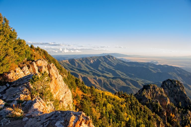
New Mexico has long been known as The Land of Enchantment. Wild horses roam the arid desert landscapes, small black bears forage the forest floors and eagles soar high above the mountain ranges.

Many come here seeking spiritual renewal, to steal a small slice of magic from New Mexico’s long-standing traditions. But what many don’t know is tucked away in these enchanting lands are an abundance of geothermal hot springs waiting to be experienced.

 Some of New Mexico’s hot springs are only accessible through a lavish resort or hidden on private property. But in this article, I’ll outline three of New Mexico’s little known hot springs.

These specific hot springs are on public land and open to any visitor willing to make the short…or long hike. I’ll also include some local hangouts that pair perfectly with your spring dip. So if you’re looking to unwind in a private setting and soak up the magic of mineral water, then these hot springs are perfect for your next New Mexico getaway.

Spence Hot Springs

Jemez National Forest, Jemez Pueblo, New Mexico

 Spence Hot Springs is a gorgeous hot spring set high above the forest floor in Jemez National Forest. Surrounded by pine trees and beautiful canyon views of Jemez, Spence Hot Springs is a great choice for those who are looking for a private spot with minimal hiking.

A bubbling geothermal cave empties its warm water into two separate rock pools. The upper pool is slightly warmer ranging in the high 90 degrees while the lower pool reaches about 85 degrees.

The trail that leads to Spence Hot Springs is a 0.6-mile developed trail that traverses over a roaring creek and follows a cool, steadily flowing waterfall all the up to the hot springs.

For the ultimate private adventure, try to get to Spence Hot Springs in the early morning hours just as the sun rises. You will beat the crowds, enjoy the colors of the infamous New Mexico sunrises and you’ll most likely have the place to yourself!

Insider Tip: When you’re on your way out to Spence Hot Springs, stop at Highway 4 Cafe and Bakery in Jemez Springs. A cozy little coffee shop nestled in a canopy of trees in downtown Jemez. Their coffee won’t disappoint and it’ll give you that little extra pep for the steep climb up to the hot springs.

How to Get to Spence Hot Springs: Spence Hot Springs is located 67 miles north of Albuquerque. If you’re headed north out of Albuquerque, you’ll take NM 4 into the town of Jemez Springs. 7 miles after the town of Jemez Springs, there will be a parking lot to your right. The parking lot is located at the trailhead of Spence Hot Springs.

As mentioned above, Spence Hot Springs is an easy to follow steep hike, crossing the San Antonio Creek. Start dipping your feet in the small waterfalls that run the course of the hike and follow the warmest one up to the hot spring!

Jordan Hot Springs

Gila National Forest, Pinos Altos, New Mexico

 The Gila National Forest is home to rolling forest hills, towering canyon walls, and the clear flowing water of the Gila River. And hidden among all the beauty is a serene hot spring.

Jordan Hot Springs is one of New Mexico’s most alluring hot springs. Its crystal clear waters, shimmering rock bottom, and magnificent surrounding landscapes draw visitors from all over the world. A perfect 93-degree pool awaits you in the middle of New Mexico’s most beautiful tree-covered wilderness.

However, this hot spring isn’t for the faint of heart. The only way to experience Jordan Hot Springs is by making the 14-mile round trip hike. The trail leading to Jordan Hot Spring is rated as moderate. Although easy in elevation gains, trekkers must cross the Gila River multiple times.

Because of the lengthy hike, this deters a lot of guests from visiting the springs — leaving Jordan Hot Springs as a great option if you’re looking for a more primitive, less crowded experience.

If you really want to get in tune with nature and the wilderness around you, opt to make this an overnight backpacking trip. Dotted along the trail that leads to Jordan Hot Springs are multiple established backcountry campgrounds. Large, cleared areas with an abundance of fire pits and clean flowing river water, the Gila Wilderness is a perfect location for turning your long hike into an unforgettable two-day adventure.

 Insider Tip: After your long afternoon soaking in Jordan Hot Springs, stop by Doc Campbell’s Post for a quick scoop of ice cream and last chance gas. Doc Campbell’s is an old-timey convenience store that’s been passed down through the generations. Souvenirs line the isles and forest animals decorate the walls. It’s a sweet little oasis and the last stop before heading back to Silver City.

How to Get to Jordan Hot Springs: The nearest town to Jordan Hot Springs is Silver City, New Mexico. Head north on NM 15 out of Silver City. Take the windy, two-lane forest road for 44 miles until you hit the trailhead labeled TJ Corral. From here, you’ll begin your 7-mile hike (one way) to the hot springs.

Manby Hot Springs

Photo by Jessica Reeder / CC BY-SA (License)

Taos, New Mexico

 Manby Hot Springs is a true treasure of New Mexico hot springs! Situated right on the banks of the Rio Grande, this small somewhat hidden hot spring is a great escape from the nearby eclectic city of Taos.

Manby Hot Springs is an undeveloped rock pool that boasts two different pools, both ranging from 90-100 degrees Fahrenheit. What draws visitors to Manby is the location and surroundings.

The views from Manby Hot Springs are the epitome of the American Southwest. A beautiful 1-mile hike leads you down into a gorge and opens up to the vast sites of the flowing Rio Grande and its surrounding canyon walls. Visitors can alternate between short dips in the Rio Grande and relaxing for hours in the hot springs.

Insider Tip: An afternoon spent relaxing in the  Manby Hot Springs calls for a margarita! Head back to downtown Taos and enjoy a margarita at The Treehouse Bar and Lounge. Located upstairs from the famous Lambert’s Restaurants, Treehouse Bar and Lounge is a swanky cocktail bar that offers handcrafted cocktails and world class margaritas. If you want to live like a local, try Benito’s red margarita – an enticing margarita with a twist of pomegranate! 

How to Get to Manby Hot Springs: If you’re heading north out of Taos, jump on 64 to NM 522. A slight left will lead you Los Rios Road that connects to Tune Road. Look for the Dobson House sign and take a left at the fork. From here, a large parking lot will lead you to the trailhead. The trail is a nice and easy downhill hike, but don’t forget to look up and take in the sights of the Rio Grande Gorge!

***

New Mexico is bubbling with geothermal activity. Whether you’re looking for a babbling riverside hideout or a mountainside escape, these New Mexico hot springs are your enchanting answer for a truly unforgettable experience!

Pin these New Mexico Hot Springs Hikes for Later!