

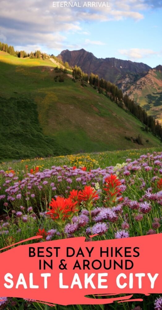
8 Best Hikes Near Salt Lake City
Salt Lake City is the capital of the state of Utah, located in the western half of the United States.
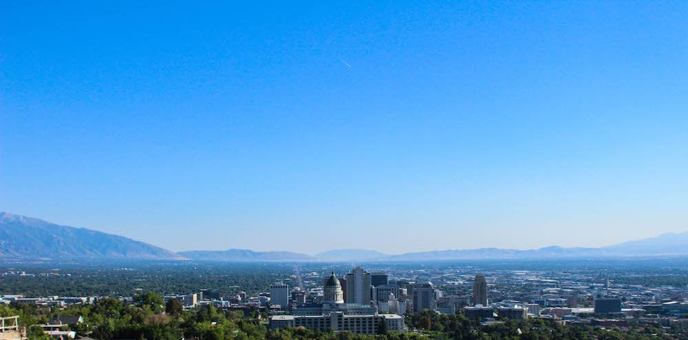
The city was built upon an ancient lake bed in a desert ecosystem and sits at just over 4,000 feet in elevation.
The city experiences the extremes of the seasons: stifling heat in the summer months and snowy, chilly winters.
Salt Lake City sits in the heart of Salt Lake Valley, surrounded almost 360° by the Oquirrh and Wasatch Mountains, the western edge of the mighty Rocky Mountain Range.
One of the most unique aspects of Salt Lake City is the proximity to trails and canyons in the Wasatch mountains.
That means that even if you have just a weekend in SLC, you have plenty of time to get in a fantastic hike!
One minute you can be walking downtown amidst the skyscrapers and traffic, and then 15 minutes later you’re surrounded by nature, with nothing but birdsong breaking the silence.
No matter what your skill level, ability, or time frame is, you can guarantee there is a perfect hike for you close by.
Want to hike to a waterfall? Along a riverbank? Reach some Insta-worthy viewpoints? You’ll have no problem finding a hike in Salt Lake City that ticks all of your boxes.
While there are literally dozens of trails to discover in and around Salt Lake City, I’ve narrowed the list down to the 8 most popular among locals and visitors.
All of these hikes are heavily-trafficked and well established.
Grab your hiking boots and trekking poles… it’s time for an adventure!
Easy Hikes In & Around Salt Lake City
Ensign Peak
Highlights: sweeping and unobstructed views of the entire Salt Lake Valley, short, urban
Length: 0.8 miles
Elevation gain: 374 feet
Located directly behind the state capitol building lies the famous Ensign Peak, a local urban hike that is one of the most popular trails around Salt Lake City.
History tells us that on July 26, 1847, just 2 days after the Mormon Pioneers entered the Salt Lake Valley for the first time, their leader, Brigham Young, led a group of men to the top of Ensign Peak. From their vantage point, the men laid out plans for their future city, Salt Lake City.
The Ensign Peak trail is about 1 mile round trip, but has an extremely steep incline the entire way to the summit. Most of the trail is unshaded, but since the trail itself is so short, it shouldn’t be a big problem for most people to hike it at any time of day and year.
When you arrive at the trailhead, follow the paved path until it forks. Stay to the right and you’ll find yourself on the steep, dirt trail. The trail will wind its way up to the summit, which you can see for most of the hike. Once you summit, you’ll find a tall monument that was erected when the first settlers summited the peak.
The Ensign Peak trail is popular with people of all ages and skill levels. When you hike it, you’ll be sure to find little kids running around, senior citizens with their hiking poles making their way up, and all sorts of family and youth groups.
The best time to hike to Ensign Peak is right before sunset, where you can watch the sun dip below the Great Salt Lake to the west.
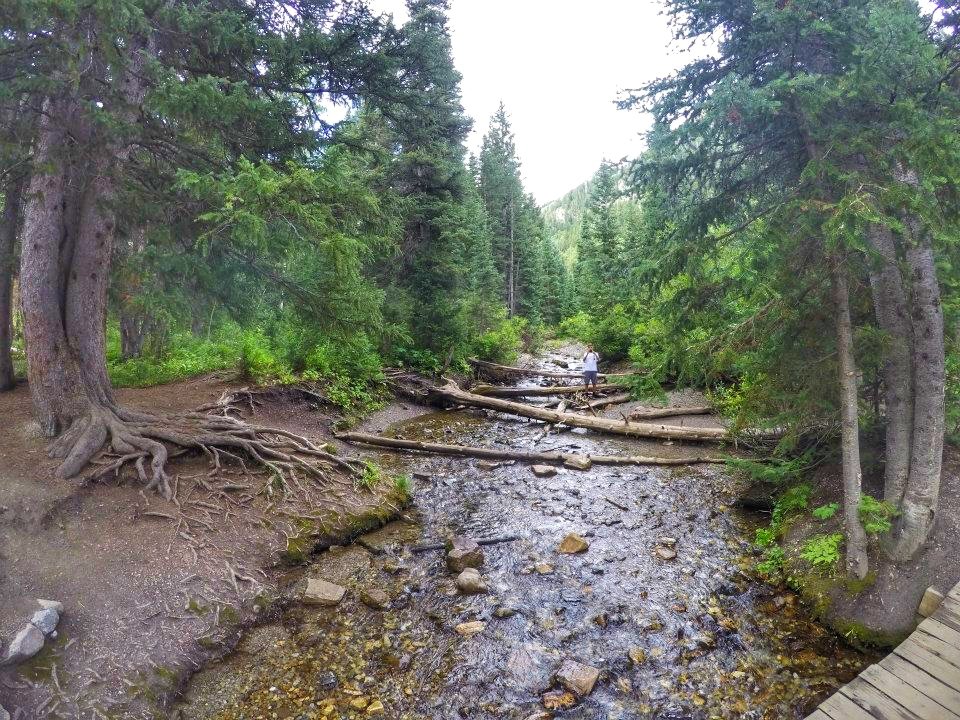
Donut Falls
Highlights: river, shaded, fun waterfall at the end of the trail
Length: 3 miles
Elevation gain: 531 feet
Who doesn’t love a good donut? And how about one that you can hike to and will last longer than an edible one? Donut Falls just might be the perfect hike for you.
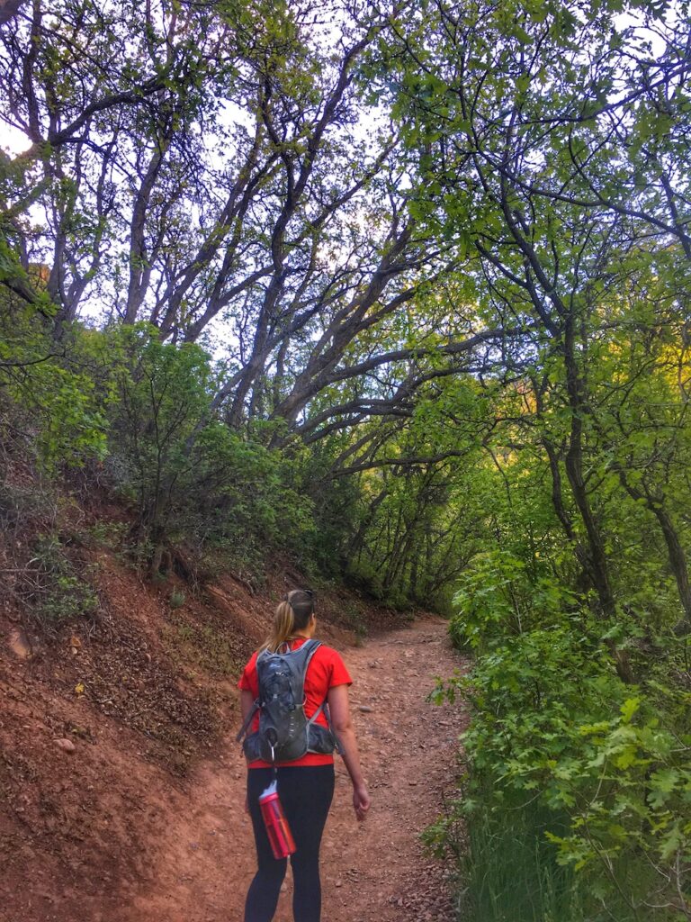
Donut Falls is a 3 mile out-and-back trail located in Big Cottonwood Canyon, just a brief drive from downtown Salt Lake City. While there is a parking lot directly at the trailhead, it becomes full pretty quickly. The Donut Falls trail is extremely popular, especially during the hot summer months.
For an unforgettable experience, wear good-fitting shoes that can get wet. Some of the trail is wet from the river and can be slick. Trekking poles for stability would also be advisable.
At the end of the shaded trail, hikers are rewarded with a beautiful waterfall cascading through a rock formation, creating the “donut” shape. If you’re wearing waterproof shoes with good grips, take care and scramble up and into the cavern for a truly unique experience.
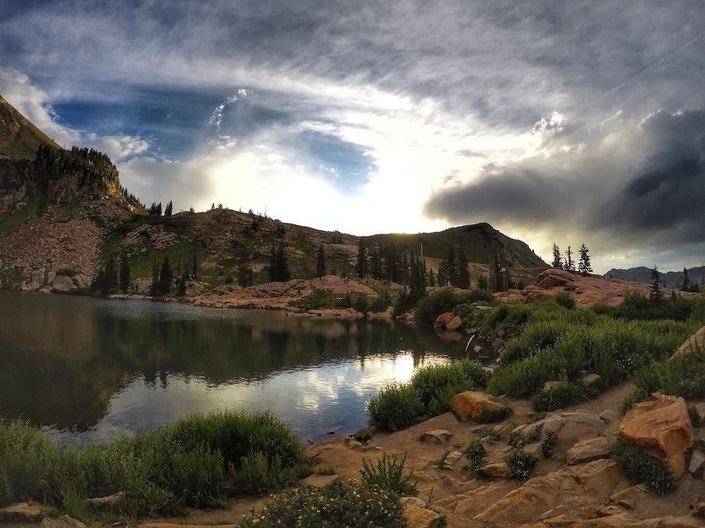
Cecret Lake
Highlights: abundant wildflowers, picturesque mountain lake
Length: 1.7 miles
Elevation gain: 459 feet
Cecret Lake (pronounced like “secret”) is a beautiful alpine lake located in Little Cottonwood Canyon, and is a wonderful family-friendly hike.
One of the best reasons Cecret Lake is such a popular trail to hike is the abundance of wildflowers in the area. The trail itself is a popular spot for photographers, so it’s nothing out of the ordinary to be on a hike and pass a few photo shoots.
The hike to Cecret Lake is only open for a few months during the later summer and fall. Since the hike is at such a high elevation, it’s common for snow to block the trail until July. This is not a hike that can be done during the snowy winter months.
Once you reach Cecret Lake, look but don’t touch. The water is part of a protected watershed for the Salt Lake Valley, so it needs to stay as uncontaminated as possible.
Hike around the lake and take in the sweeping views of the snow-capped mountains, vibrant wildflowers and some of the bluest sky you can find.
Moderate Hikes In & Around Salt Lake City
The Living Room Lookout

Highlights: epic views, rock furniture at the summit (explained below)
Length: 2.3 miles
Elevation gain: 980 feet
Depending on your level of skill and adventure, you could technically classify the Living Room Lookout hike as either easy or moderate. If you take a wrong turn and wind up scaling the face of the mountain, it could even be classified as difficult.
The trailhead for the Living Room Lookout hike is located on the University of Utah property, just southwest of the Utah Museum of Natural History.
The trail leads up a pretty narrow path and actually follows a wash at some points. There are quite a few offshoots, but stay to the right and you’ll keep on the correct path. There is just under 1,000 feet elevation gain over a 2.3 mile steep round trip.
There is minimal to no shade, so plan accordingly. Bring plenty of water and consider the time of day that you’re hiking. The trail faces west, so early morning before the sun peaks in the sky is going to be the most ideal time.
The big draw for hiking up to the Living Room Lookout is the setup at the top. The rocks have been arranged to look like couches and lounge chairs, facing the valley lookout, creating an epic backdrop for photos.
Even if you can’t make it to the top, you’re going to have an unbelievable view at every turn along the trail.
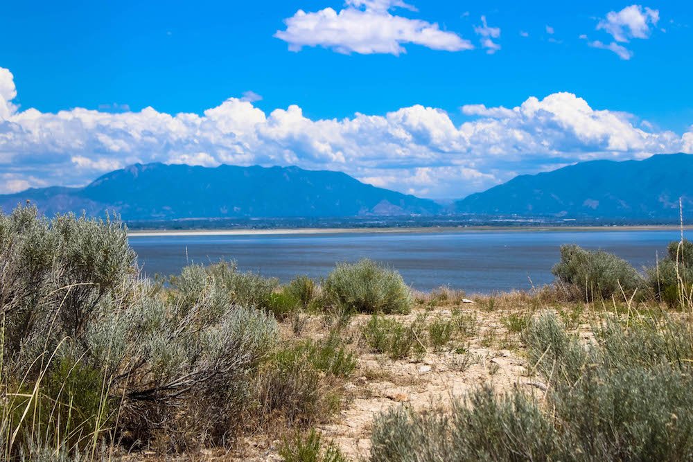
Dooly Knob Trail (Antelope Island)
Highlight: wildlife, island views
Length: 2.4 miles
Elevation gain: 705 feet
There’s just something special about hiking on an island, when the views constantly remind you how epic your location is.
Antelope Island is located in the Great Salt Lake, and offers multiple hikes for adventures of all skill levels. The Dooly Knob trail just happens to be the most popular.
The hike to Dooly Knob is best done in the cooler months. Antelope Island is known for having biting bugs during the spring and early summer months. If you want to hike during that time, keep in mind any exposed skin.
The first part of the trail is a little brutal for some inexperienced hikers. For 0.75 miles at the beginning, you’ll be hiking almost straight up at a steep incline. As you stop and catch your breath, take a look around and enjoy the views of the beach, the mountains, and the urban city skyline.
As you make your way to the summit, keep your eyes peeled for wildlife. Antelope Island is known for having antelope, coyote, a herd of buffalo, and a variety of smaller wildlife.
Fifth Water Hot Springs Trail
Highlights: river, vegetation, hot springs, waterfall
Length: 4.5 miles
Elevation gain: 636 feet
The Fifth Water Hot Springs Trail is a beautifully shaded pathway in Diamond Fork Canyon, about an hour south of downtown Salt Lake City.
The path follows along a river, leading to milky blue hot spring pools. So when you hike this trail, make sure you have a swimsuit with you, or at least something that you don’t mind getting wet.
From the trailhead, follow the trail southeast along the east bank of Sixth Water Creek. Do not cross the footbridge. After a mile, you will come to another foot bridge, which you should cross. This is the junction of Sixth Water Creek (from the left) and Fifth Water Creek (from the right).
Stay to the right and continue your hike along the heavily-trafficked creek trail. After about a mile, you’ll begin to notice that the water turns a milky blue color. Your nose hairs will start to curl as well, because the smell of sulfur will only increase the closer you get to the hot springs.
Once you reach the hot springs, relax and soak it all in (see what I did there?). Scramble up to the top of the nearby waterfall. Set up a hammock. Take all the pictures. Truly enjoy your time before you make the hike back to the trailhead.
Difficult Hikes In & Around Salt Lake City
Mount Timpanogos via Timpooneke
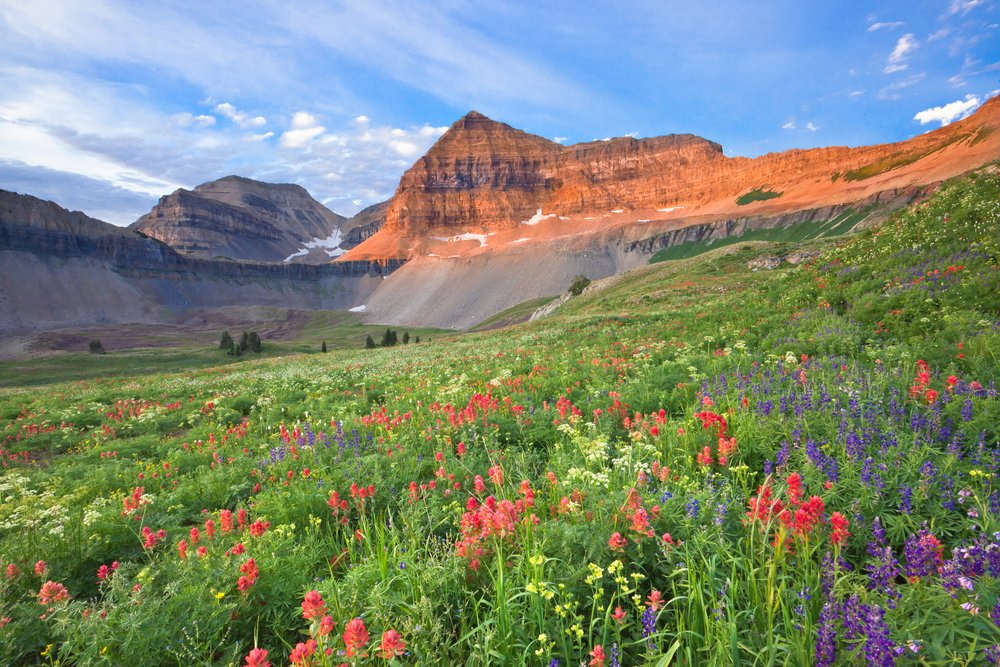
Highlights: stunning view of the Wasatch mountain range, abundant wildflowers, wild animal sightings almost a guarantee, clout
Length: 12.8 miles
Elevation gain: 4,425 feet
Summiting Mount Timpanogos is one of the most popular hikes in the entire state of Utah. While there are two options for you to take to the summit, the Timpooneke trail is the more desirable of the two routes. The trailhead is located about 50 miles southeast of downtown Salt Lake City.
The hike up Mount Timpanogos is extremely arduous and many of the switchbacks can be strenuous. You’ll want to make sure that you’re in decent shape before attempting the hike. Some locals even choose to run this trail, but I wouldn’t recommend it unless you’re an experienced trail runner at high elevations.
If you choose to do this hike during the day, keep in mind that it gets extremely hot. Bring plenty of water. Even if you do this hike in the middle of the summer, keep in mind that there is a great chance of ice/snow once you reach the saddle.
One of the best things about hiking up Mount Timpanogos is reaching the summit for the sunrise. Depending on your ability, you’ll want to begin your hike around midnight to ensure you reach the summit by the 6am sunrise.
Although you might work up a sweat on the way up, you’ll need to bring warm clothing. If you reach the summit before sunrise and have to wait for it, it’ll get cold, especially since you’ve worked up a sweat getting there. We arrived about an hour before the sunrise and huddled together, taking in the views.
Mount Olympus
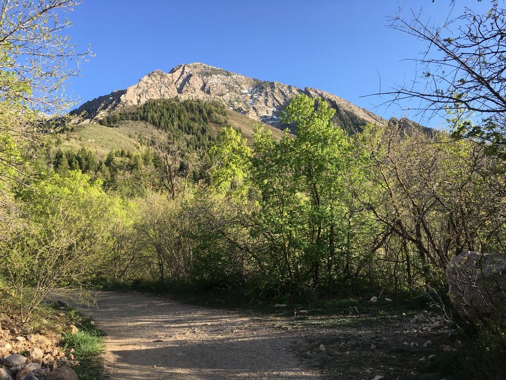
Highlights: city views, wildflowers, clout
Length: 8 miles
Elevation gain: 4,192 feet
Zeus was the king of the gods and reigned from Mount Olympus, ruling the world and imposing his will on mortals. While you won’t find Zeus atop this particular Mount Olympus, you can still feel as powerful as he did, knowing that you have summited one of the hardest hikes in the state of Utah.
Before you begin the hike, keep in mind that the trail isn’t very well-marked. I recommend downloading an offline map to keep you on the correct path, especially since cellular reception can be hit-or-miss.
The hike up to Mount Olympus is unforgiving and exposed most of the trail. Bring plenty of water and opt to hike early in the morning. Take your time and ask for directions if you need it.
Looking at the length to elevation gain ratio, you should be able to tell right away that this hike is quite steep. Trekking poles or a walking stick are highly recommended to assist with your ascent. Because the trail ascends so quickly, you’ll be amazed at how abruptly you’ll find yourself in alpine terrain, leaving behind the hustle and bustle of the city below.
The last section of the hike is almost like a mountaineering scramble, so take care to stretch well before you begin. You’ll also want to take plenty of time after the hike to cool off and stretch out your muscles, particularly your calves. If you skip this step, there’s a great chance you’ll have dead legs for a few days.
Hiking to the top of Mount Olympus is not for the faint of heart. Prepare yourself mentally for the scramble to the summit and take your time. Once you reach the top, your reward will be simply stunning. And you’ll have bragging rights for life!
About the Author
Rachelle is the writer and creator behind the website Adventure is Never Far Away. After moving to Utah in 2009, Rachelle was finally bitten by the travel bug and started to travel around the world and in her own backyard. She has been determined to prove that adventures can be found anywhere. You don’t have to go far to find an adventure!
You can find her blog at Adventure is Never Far Away, and you can follow along with her adventures on Instagram, Pinterest, and Facebook.
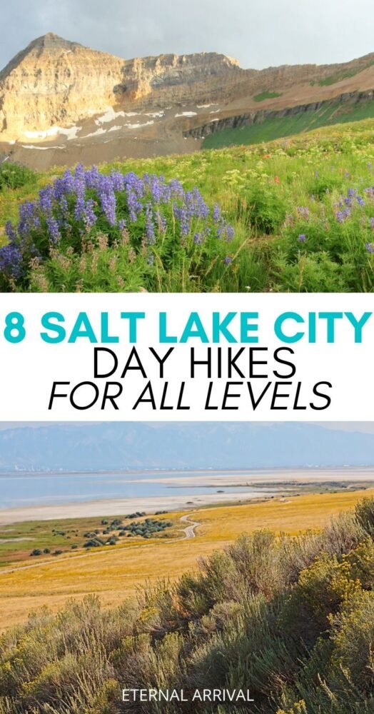
Pin These Salt Lake City Hikes!

Allison Green is a former teacher who has been travel blogging since 2016, visiting 75+ countries in total. She has a Masters in Teaching and a B.A. in English and Creative Writing. As a former educator, she merges her writing and educational experience to encourage ethical, sustainable travel. She has been a speaker at the World Travel Writers Conference and TBEX. Her writing, photography, and podcasting work has appeared in National Geographic, CNN Arabic, CBC Canada, and Forbes, amongst others. When she’s not on the road, she lives in Bangkok, Thailand.